Translate

Showing posts sorted by relevance for query noaa. Sort by date Show all posts

25 Apr 2021

email to NOAA about lost cities i discovered


email to NOAA about lost cities i discovered

Get on this, who da man, oh yeah that would be me lol finder of 4 lost cities, cracker of ultimate questions, revealer of hidden knowledge, truth's and things, and general ass kicker extraordinaire, 
aka moi The Hidden,
 aka D W Law

You know those lost cities i found well pmsl someone from NOAA is trying to claim they just found 1 of them 2 months ago pmsl so i emailed them and dropped the links i shared back in 2018 , unlucky says i you've got to be fast or your last these days me ol cockers see 

NOAA page link 

copy of email title of noaa article dated feb 2021 lol "Did I find the lost underwater civilization of Atlantis?"
was the question posed b NOAA in 2021 the answer is no, i found it some years before 2018 and another 3 lost cities and i fully documented and published my findings, attached are the published articles and the other 3 cities, i also took the liberty of naming all three and a pyramid structure located at the east end of one of the cities see links for evidence

regards

D W Law

The Hidden!: second city Nibaru and tracks (ediovision.blogspot.com)

The Hidden!: city 1 city of Xena (ediovision.blogspot.com)

The Hidden!: "Thule", city 3 (ediovision.blogspot.com)

The Hidden!: City of, "Vineta" (ediovision.blogspot.com)

14 Apr 2018

NOAA interactive global data sources and maps

NOAA  interactive global data sources and maps


https://www.nnvl.noaa.gov/view/globaldata.html


Information
The NOAA View data imagery portal provides access to NOAA's wealth of global data resources. Data on this site is intended for outreach and education purposes only and is not considered part of NOAA's official data centers.

28 Dec 2018

underwater pre-diluvian discoveries i made, a city a solar calendar a pyramid 3 uso's and other strange anomalies, so lets crack on and make histroy change forever, shall we?

underwater pre-diluvian discoveries i made, a city a solar calendar a pyramid 3 uso's and other strange anomalies, so lets crack on and make histroy change forever, shall we?

city of Xena


i'd like to announce yet again mainly because i want to make sure you all know thins, but I' believe I've found the world oldest known solar calendar and a submerged temple and giant submerged city with pyramid and several large uso's and a lot more besides that, and whats more i can prove it with more than enough evidence to sway any jury in any land of what i'm telling you and showing you, all for free may i add, usually you can't see it without knowing how to look and using what site and even then its only by sheer luck that they have missed them, when they were sanitising the data's from google earth and NOAA maps, and a few more high resolution satellite imagery sites, i wouldn't mind but there's been a clear attempt to hide certain things, as i went back to the original link i shared and the entire of the NOAA web maps pages have been shut down and removed (Ooopp's was it something i said) but i manage to find away back in and i have managed to find uncensored image data of online via a bit of smart brain work, and I've put it all together right down to the GPS coordinates for you, with images and video and I've named the features that i found and can even provide you with a way to view these places in full 3d just like i do in the video bellow, and these site are of major historic value to the peoples and nations of Earth, it proves that they had advanced concepts such as mathematics, astronomy, space, particle wave physics, geometry and technology way before what the modern history books teach us, they want us to believe we only just arrived in our current state from Neanderthals and that's just a flat out lie, we have been in more higher advanced states of technology and understanding and spirituality than we currently have many times, and we keep on getting blown back to the stone age by wankers who play dice with all of our lives for profit, and the descendants of the survivors "us" have to piece our collective past back together, we are a species with amnesia, and i'm here to rectify the problem and to say other wise and deny the evidence of your own eyes is just plain arrogant and foolish to say the least, given that this site is 4000 ft beneath the waves, making it very old given the location and it wouldn't surprise me if it were connected to Hy-Brasil, so lets down to business and do feel free to open these video's up in full screen and images its all in hd, unlike when i tried to post them on fakebook and other platforms, meanwhile here i'm the Alpha and Omega and i do it my way, so Enjoy and Bon Appétit and dont forget to share lol. :) #peace D.

Lawd's Solar calendar

the solar calendar i call it the Lawd's calendar given it predates the only other example of this which is called Adam's calendar in Africa from 11500 bc and given its depth and location must predate it

Depth min 3299m
Depth max 3305.4m
Depth average 3298.6m
Elementary surfaces 4
Depth smoothed 3291.36m

Depth smoothed offset 7.239999999999782
CDI Id 366_Zone_3_PAD_100M_WGS84

Latitude 54.942352292826406
Longitude -22.131683345418427

bellow is the one in Africa and it shows the alignments towards the cardinal points

Adams calendar

Lawd's calendar
now here's mine 
excuse the non perfectly ocd straight image, i wanted to snap it before it disappeared 12.143 km east to west and north to south just north of the rohan seamount, yes its big very big


if you cant see the alignments its OK i know its difficult if you don't know what your looking at, but those lines follow paths that point to summer and winter solstices and the like its your old analogue earth clock a giant sundial of sorts

Submerged City of Xena,
moving on, i named the submerged city the city of Xena, and the pyramid so here for you bellow is the city and all the evidence and proof you could ever require short of getting wet, that would be a complex 145 kn 90 miles in distance north to south around 216 kn east to west 150 miles across submerged 4000 ft beneath the ocean surface, i wasn't to say nature does not make intersecting grids patterns and right angles and cross road sections or pyramids with four sides. we humans however do,

Depth average 4705.6m
Elementary surfaces 1
Depth smoothed 4705.68m
Depth smoothed offset 0.07999999999992724
DTM Source GEBCO_2014
cantered on direct centre of city

Latitude 51.53466786816716
Longitude -18.65039069205523

555km  331 miles due west  of the south western tip of Ireland
i hope you like these tasty image's and video i will add bellow and direct links free to share all of it and GPS coordinates that i'm giving you, if you lack the programs to view this directly for yourself and be able to swish about underwater without getting wet, to look for hidden things get at me, i cannot post the direct link because NOAA shut the last web site down, because and i'm guessing they noticed a large influx of people from all over the planet in their online data (lol) that and i posted it everywhere on you tube emails across different continents and all for free, because i'm not a fucking sell out, (evidence this is the original link it now goes to this

 https://www.ngdc.noaa.gov/maps/water_column_sonar/index.html

NOAA Page Header

The website you are trying to access is not available at this time due to a lapse in appropriation.
NOAA.gov and specific NOAA websites necessary to protect lives and property are operational and will be maintained during this partial closure of the U.S. Government. but its OK where there is a will there is always a way, as i think i'm mid way proving lol

So Peep's please remember where you heard all this, and my names for them and mine,
 as its only fair to give credit where it is due, 
Thanks for reading, 
also sharing is caring.
😁😁😁👇👇😎🌍☮️


ladies and gentlegerms i give you the city of Xena


not convinced yet?, keep going you will be, check out the videos

city of Xena video.1

hd 3d images

Edio's Pyramid.
 this bellow is a topographic analysis of the city. basically the darker blue means its lower the lighter the blue it gets it means its higher, so anything lighter is raise above the rest of the natural level (artificial) of the surrounding sea bed

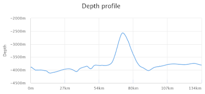
 that single dot of light blue in the middle of the shot that's the peak of the pyramid over 1500 meters higher than the surrounding area and is a four sided pyramid and i want to put this into perspective for you, the great pyramid at Giza is 139 meters high this is 1500 meters high with a base of 40 square miles 10 miles per side and that makes it far bigger also is 4000ft beneath the waves i  shit you not and i'm going to show you the proof and i have more evidence, so stay with me on this cos i have it all.

depth sounding measurements
Depth average 2777.4m
Elementary surfaces 1
Depth smoothed 2779.6m
Depth smoothed offset 2.199999999999818
DTM Source GEBCO_2014
Latitude 51.27978515625001
Longitude -19.599609173834324

this is the same measurement at the last but right next to the pyramids base 
Depth average 3756.81m  (notice the difference 1000+ meters and that's only the average i got way more specific evidence than that peep's)
Elementary surfaces 1
Depth smoothed 3757.09m
Depth smoothed offset 0.2800000000002001
DTM Source GEBCO_2014
Latitude 50.86669915169478
Longitude -19.582031317055225

there's are sonar projections of the sea bed and its in a side view perspective like a profile side shot

north to south directly across the pyramid pyramid only


east to west across the pyramid pyramid only


east to west across entire city running directly over the centre of the pyramid and the rest of the city
 

north to south over center of pyramid and the rest of the city

3d video


USO's, (Unidentified Submerged Object)

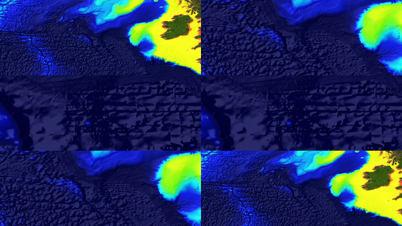
the Initial positions and how they looked


USO 1
Depth average 2779.8m
Elementary surfaces 2
Depth smoothed 2775.9m
Depth smoothed offset 3.900000000000091
CDI Id 366_Zone_3_PAD_100M_WGS84
Latitude 52.59429930802435
Longitude -19.70013427734375


now looks like this 


USO 2
Depth average 2627.6m
Elementary surfaces 2
Depth smoothed 2622.88m
Depth smoothed offset 4.7199999999998
CDI Id 366_Zone_3_PAD_100M_WGS84
Latitude 52.803588862996556
Longitude -19.504028328694407


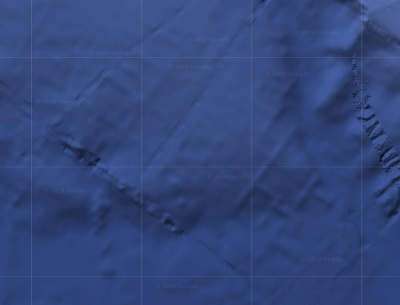
looks at these lines they aren't a graphic artefact or editing glitch from where they have edited them out the uso;s have gone completely leaving behind these ridges and grooves, we can make a logical guess that they retrieved what was there and this is the structure that remained underneath.


USO 3
Depth average 2493m
Elementary surfaces 2
Depth smoothed 2493.02m
Depth smoothed offset 0.01999999999998181
CDI Id 366_Zone_3_PAD_100M_WGS84
Latitude 53.31884765625
Longitude -18.564147936645895


 and the last one looks like this

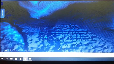
 you can see structure's that have been blurred out in the entire region, it is within the realm of possibility that they know of the city of sorts, and it is being intentionally blurred from the maps, given the high amount of 1 mile wide tracks from what appears to be a Caterpillar track drive like a giant tractor or possibly if you have seen the film the abyss there is an undersea drilling platform that moves on tracks, it would dwarf that but same principle applies as there are huge channels a mile wide cut in hundreds of miles lengths, have you seen a farmers field when they plough it and they sweep up and down the field in rows until they get to the end and they anchor round on themselves and come back down, well there's a lot of that sort of thing too, and quite a few other things i found on there such as what appears to be a multiple massive entrance's of some kind and the whole area is heavily blurred, and other strangeness but tell me what you think to those, i'm sure you will find it as fascinating as me, given the depth 4000+ft beneath the waves, now i'm not a qualified geologist but i'm pretty sure at that depth it would have to make it the worlds oldest city and solar calendar and pyramid ever found, should you have any questions feel free to direct them to me via dazlaw88@gmail.com or darren law on fb as I've already caught google removing the message and images regarding this that i shared with a archaeologist and a scientist and a few others and received some very positive feed back thanks peeps, 

stay tuned for more weirdness 

20 Feb 2020

Repost of my findings of 4 lost cities and a pyramid & 3 uso's

Repost of my findings of 4 lost cities and a pyramid & 3 uso's

, plus the links to view them on and the link to the same map server WMS as i use, you can see some of them on google earth but not in as greater detail, the names i will list them all the 4 city's then the other features, there's Xena west of Ireland North Sea, i named it after someone very important to me, then i let a friend name another so i had no call in this one, but she went for Nibaru west coast of Africa right next to Monaco deep North Atlantic, its right there in the gebco base layer nobody called it out though, like the rest of them, then there is Thule west coast of Greenland this one was a little tricky to find but still highly visible in google earth, even the buildings that have been suspiciously blurred on the edge of the boundary line is clear as day see the squared forms of buildings and the clear evidence of agriculture and lines and if you can't see it perhaps you should have gone to specsavers, i also added some info on the historical data for said places some variants of the maps have more details on than others here are the links and you can check all these yourself, it proves that there were past advanced cities with technologically advanced ways of building so they must have had mathematics you can't have that without certain levels of systems of knowledge in play, so any way i waffled on for quite a bit, so here are the links and the link to the high def web map server WMS


underwater pre-diluvian discoveries i made, a city a solar calendar a pyramid 3 uso's and other strange anomalies, so lets crack on and make histroy change forever, shall we?

city of Xena


i'd like to announce yet again mainly because i want to make sure you all know thins, but I' believe I've found the world oldest known solar calendar and a submerged temple and giant submerged city with pyramid and several large uso's and a lot more besides that, and whats more i can prove it with more than enough evidence to sway any jury in any land of what i'm telling you and showing you, all for free may i add, usually you can't see it without knowing how to look and using what site and even then its only by sheer luck that they have missed them, when they were sanitising the data's from google earth and NOAA maps, and a few more high resolution satellite imagery sites, i wouldn't mind but there's been a clear attempt to hide certain things, as i went back to the original link i shared and the entire of the NOAA web maps pages have been shut down and removed (Ooopp's was it something i said) but i manage to find away back in and i have managed to find uncensored image data of online via a bit of smart brain work, and I've put it all together right down to the GPS coordinates for you, with images and video and I've named the features that i found and can even provide you with a way to view these places in full 3d just like i do in the video bellow, and these site are of major historic value to the peoples and nations of Earth, it proves that they had advanced concepts such as mathematics, astronomy, space, particle wave physics, geometry and technology way before what the modern history books teach us, they want us to believe we only just arrived in our current state from Neanderthals and that's just a flat out lie, we have been in more higher advanced states of technology and understanding and spirituality than we currently have many times, and we keep on getting blown back to the stone age by wankers who play dice with all of our lives for profit, and the descendants of the survivors "us" have to piece our collective past back together, we are a species with amnesia, and i'm here to rectify the problem and to say other wise and deny the evidence of your own eyes is just plain arrogant and foolish to say the least, given that this site is 4000 ft beneath the waves, making it very old given the location and it wouldn't surprise me if it were connected to Hy-Brasil, so lets down to business and do feel free to open these video's up in full screen and images its all in hd, unlike when i tried to post them on fakebook and other platforms, meanwhile here i'm the Alpha and Omega and i do it my way, so Enjoy and Bon Appétit and dont forget to share lol. :) #peace D.

Lawd's Solar calendar

the solar calendar i call it the Lawd's calendar given it predates the only other example of this which is called Adam's calendar in Africa from 11500 bc and given its depth and location must predate it

Depth min 3299m
Depth max 3305.4m
Depth average 3298.6m
Elementary surfaces 4
Depth smoothed 3291.36m

Depth smoothed offset 7.239999999999782
CDI Id 366_Zone_3_PAD_100M_WGS84

Latitude 54.942352292826406
Longitude -22.131683345418427

bellow is the one in Africa and it shows the alignments towards the cardinal points

Adams calendar

Lawd's calendar
now here's mine 
excuse the non perfectly ocd straight image, i wanted to snap it before it disappeared 12.143 km east to west and north to south just north of the rohan seamount, yes its big very big


if you cant see the alignments its OK i know its difficult if you don't know what your looking at, but those lines follow paths that point to summer and winter solstices and the like its your old analogue earth clock a giant sundial of sorts

Submerged City of Xena,
moving on, i named the submerged city the city of Xena, and the pyramid so here for you bellow is the city and all the evidence and proof you could ever require short of getting wet, that would be a complex 145 kn 90 miles in distance north to south around 216 kn east to west 150 miles across submerged 4000 ft beneath the ocean surface, i wasn't to say nature does not make intersecting grids patterns and right angles and cross road sections or pyramids with four sides. we humans however do,

Depth average 4705.6m
Elementary surfaces 1
Depth smoothed 4705.68m
Depth smoothed offset 0.07999999999992724
DTM Source GEBCO_2014
cantered on direct centre of city

Latitude 51.53466786816716
Longitude -18.65039069205523

555km  331 miles due west  of the south western tip of Ireland
i hope you like these tasty image's and video i will add bellow and direct links free to share all of it and GPS coordinates that i'm giving you, if you lack the programs to view this directly for yourself and be able to swish about underwater without getting wet, to look for hidden things get at me, i cannot post the direct link because NOAA shut the last web site down, because and i'm guessing they noticed a large influx of people from all over the planet in their online data (lol) that and i posted it everywhere on you tube emails across different continents and all for free, because i'm not a fucking sell out, (evidence this is the original link it now goes to this

 https://www.ngdc.noaa.gov/maps/water_column_sonar/index.html

NOAA Page Header

The website you are trying to access is not available at this time due to a lapse in appropriation.
NOAA.gov and specific NOAA websites necessary to protect lives and property are operational and will be maintained during this partial closure of the U.S. Government. but its OK where there is a will there is always a way, as i think i'm mid way proving lol

So Peep's please remember where you heard all this, and my names for them and mine,
 as its only fair to give credit where it is due, 
Thanks for reading, 
also sharing is caring.
😁😁😁👇👇😎🌍☮️


ladies and gentlegerms i give you the city of Xena


not convinced yet?, keep going you will be, check out the videos
city of Xena video.1

hd 3d images

Edio's Pyramid.
 this bellow is a topographic analysis of the city. basically the darker blue means its lower the lighter the blue it gets it means its higher, so anything lighter is raise above the rest of the natural level (artificial) of the surrounding sea bed

 that single dot of light blue in the middle of the shot that's the peak of the pyramid over 1500 meters higher than the surrounding area and is a four sided pyramid and i want to put this into perspective for you, the great pyramid at Giza is 139 meters high this is 1500 meters high with a base of 40 square miles 10 miles per side and that makes it far bigger also is 4000ft beneath the waves i  shit you not and i'm going to show you the proof and i have more evidence, so stay with me on this cos i have it all.

depth sounding measurements
Depth average 2777.4m
Elementary surfaces 1
Depth smoothed 2779.6m
Depth smoothed offset 2.199999999999818
DTM Source GEBCO_2014
Latitude 51.27978515625001
Longitude -19.599609173834324

this is the same measurement at the last but right next to the pyramids base 
Depth average 3756.81m  (notice the difference 1000+ meters and that's only the average i got way more specific evidence than that peep's)
Elementary surfaces 1
Depth smoothed 3757.09m
Depth smoothed offset 0.2800000000002001
DTM Source GEBCO_2014
Latitude 50.86669915169478
Longitude -19.582031317055225

there's are sonar projections of the sea bed and its in a side view perspective like a profile side shot

north to south directly across the pyramid pyramid only


east to west across the pyramid pyramid only


east to west across entire city running directly over the centre of the pyramid and the rest of the city
 

north to south over center of pyramid and the rest of the city

3d video


USO's, (Unidentified Submerged Object)

the Initial positions and how they looked

USO 1
Depth average 2779.8m
Elementary surfaces 2
Depth smoothed 2775.9m
Depth smoothed offset 3.900000000000091
CDI Id 366_Zone_3_PAD_100M_WGS84
Latitude 52.59429930802435
Longitude -19.70013427734375


now looks like this 


USO 2
Depth average 2627.6m
Elementary surfaces 2
Depth smoothed 2622.88m
Depth smoothed offset 4.7199999999998
CDI Id 366_Zone_3_PAD_100M_WGS84
Latitude 52.803588862996556
Longitude -19.504028328694407


looks at these lines they aren't a graphic artefact or editing glitch from where they have edited them out the uso;s have gone completely leaving behind these ridges and grooves, we can make a logical guess that they retrieved what was there and this is the structure that remained underneath.


USO 3
Depth average 2493m
Elementary surfaces 2
Depth smoothed 2493.02m
Depth smoothed offset 0.01999999999998181
CDI Id 366_Zone_3_PAD_100M_WGS84
Latitude 53.31884765625
Longitude -18.564147936645895


 and the last one looks like this

 you can see structure's that have been blurred out in the entire region, it is within the realm of possibility that they know of the city of sorts, and it is being intentionally blurred from the maps, given the high amount of 1 mile wide tracks from what appears to be a Caterpillar track drive like a giant tractor or possibly if you have seen the film the abyss there is an undersea drilling platform that moves on tracks, it would dwarf that but same principle applies as there are huge channels a mile wide cut in hundreds of miles lengths, have you seen a farmers field when they plough it and they sweep up and down the field in rows until they get to the end and they anchor round on themselves and come back down, well there's a lot of that sort of thing too, and quite a few other things i found on there such as what appears to be a multiple massive entrance's of some kind and the whole area is heavily blurred, and other strangeness but tell me what you think to those, i'm sure you will find it as fascinating as me, given the depth 4000+ft beneath the waves, now i'm not a qualified geologist but i'm pretty sure at that depth it would have to make it the worlds oldest city and solar calendar and pyramid ever found, should you have any questions feel free to direct them to me via dazlaw88@gmail.com or darren law on fb as I've already caught google removing the message and images regarding this that i shared with a archaeologist and a scientist and a few others and received some very positive feed back thanks peeps, 

stay tuned for more weirdness 


more evidence in the form of a sonar animation stitched to gathered from various infrared images of the underwater site city of "Xena"  its much bigger than i initially thought

please open it up in full screen HD

City Of Xena infrared + sonar heatmap ping


Fly over "Xena" stop motion animation, 
it took ages to do each frame by frame 
🙏❤️🧠🌍☮️


vertical zoom

Looking East to west at Edio's Pyramid

NNW
 N

topographic view (top down)

topographic view (top down)

topographic view (top down)
N

topographic view (top down)

birds eye zoom 1
birds eye zoom  2
birds eye zoom 3
birds eye zoom 4


sonar ping heat map of Xena city gif and YouTube format


Edio's pyramid at the city of Xena with seabed sonar cross sections videos pics

 its base is 40 square miles that's 10 miles a side and it rises up over 1500 meters, and just so you know the great pyramid at Giza is only 139 meters high so yeah, its located on the western side of the city of Xena you know that massive city that's 150 miles across 4000 ft beneath the waves west of Ireland

Edio's pyramid located in the west of the Xena city complex,
Latitude 51.242431640625
Longitude -19.584228549152613


second city "Nibaru" with evidence of "tank tracks" 8000km long

Depth average 5456m
Elementary surfaces 1
Depth smoothed 5452.22m
Depth smoothed offset 3.7799999999997453
DTM Source GEBCO_2014
Latitude 31.40620850229478
Longitude -24.48567471416044

the blue line is me measuring the tracks as far as i could,

 zooming in 

 closer

 a Little more

and a Little more

i give you "Nibaru", 

168 km east to west 128km north to south 534 square kilometres
tracks are 7.45645 miles wide

Enjoy


My underwater discovery of "Thule", 
63.455426 -54.318756


Thule (/ˈθjuːliː/ THEW-lee[1] Greek: Θούλη Thoúlē, Latin: Thūlē) is the farthest north location mentioned in ancient Greek and Roman literature and cartography. Modern interpretations have included Orkney, Shetland, the island of Saaremaa (Ösel) in Estonia,[2][3] and the Norwegian island of Smøla.[4]

and were all wrong, In classical and medieval literature, ultima Thule (Latin "farthermost Thule") acquired a metaphorical meaning of any distant place located beyond the "borders of the known world".[5] By the late middle ages and early modern era, the Greco-Roman Thule was often identified with the real Iceland or Greenland. Sometimes Ultima Thule was a Latin name for Greenland, when Thule was used for Iceland.[6] By the late 19th century, however, Thule was frequently identified with Norway.

In the early seventh century, Isidore of Seville wrote in his Etymologies that:

Ultima Thule (Thyle ultima) is an island of the Ocean in the northwestern region, beyond Britannia, taking its name from the sun, because there the sun makes its summer solstice, and there is no daylight beyond (ultra) this. Hence its sea is sluggish and frozen.[42]

Isidore distinguished this from the islands of Britannia, Thanet (Tanatos), the Orkneys (Orcades), and Ireland (Scotia or Hibernia).[42] Isidore was to have a large influence upon Bede,[43] who was later to mention Thule.

By the late Middle Ages, scholars were linking Iceland and/or Greenland to the name Thule and/or places reported by the Irish mariner Saint Brendan (in the 6th century) and other distant or mythical locations, such as Hy Brasil and Cockaigne. These scholars included works by Dicuil (see above), the Anglo-Saxon monk the Venerable Bede in De ratione temporum, the Landnámabók,[citation needed] by the anonymous Historia Norwegie,[citation needed] and by the German cleric Adam of Bremen in his Deeds of Bishops of the Hamburg Church, where they cite both ancient writers' use of Thule as well as new knowledge since the end of antiquity. All these authors also understood that other islands were situated to the north of Britain.

Eustathius of Thessalonica, in his twelfth-century commentary on the Iliad, wrote that the inhabitants of Thule were at war with a tribe whose members dwarf-like, only 20 fingers in height.[44] The American classical scholar Charles Anthon believed this legend may have been rooted in history (although exaggerated), if the dwarf or pygmy tribe were interpreted as being a smaller aboriginal tribe of Britain the people on Thule had encountered.[45]

Petrarch, in the fourteenth century, wrote in his Epistolae familiares ("Familiar Letters") that Thule lay in the unknown regions of the far north-west.[46]

A madrigal by Thomas Weelkes, entitled Thule (1600), describes it with reference to the Icelandic volcano Hekla:

Thule, the period of cosmography,
Doth vaunt of Hecla, whose sulphureous fire
Doth melt the frozen clime and thaw the sky;
Trinacrian Etna's flames ascend not higher ...[47]

The English poet Ambrose Philips began, but did not complete, a poem concerning The Fable of Thule which he published in 1748.

Thule is referred to in Goethe's poem "Der König in Thule" (1774), famously set to music by Franz Schubert (D 367, 1816), Franz Liszt (S.531) and Robert Schumann (Op.67, No.1), and in the collection Ultima Thule (1880) by Henry Wadsworth Longfellow.

Modern literature

Edgar Allan Poe's poem "Dream-Land" (1844) begins with the following stanza:
By a route obscure and lonely,
Haunted by ill angels only,
Where an Eidolon, named Night,
On a black throne reigns upright.
I have reached these lands but newly
From an ultimate dim Thule –
From a wild weird clime, that lieth, sublime,
Out of Space – out of Time.

John Henry Wilbrandt Stuckenberg wrote on the subject in 1885:

What is the mind’s ultima Thule? What substance must be regarded as first, and therefore as the seed of the universe? What is the eternal Something, of which the temporal is but a manifestation? Matter? Spirit? Matter and Spirit? Something behind both and from which they have sprung, neither Matter nor Spirit, but their Creator? Or is there in reality neither Matter nor Spirit, but only an agnostic Cause of the phenomena erroneously assigned by us to body and mind?

After spending many years in profoundly investigating this problem, I have at last struck bottom. Unhesitatingly and unconditionally I adopt materialism, and declare it to be the sole and all-sufficient explanation of the universe. This affords the only thoroughly scientific system; and nowhere but in its legitimate conclusions can thought find suitable resting-place, the heart complete satisfaction, and life a perfect basis. Unless it accepts this system, philosophy will be but drift-wood, instead of the stream of thought whose current bears all truth. Materialism, thorough, consistent, and fearless, not the timid, reserved, and half-hearted kind, is the hope of the world.

— The Final Science: or Spiritual Materialism (1885) by John Henry Wilbrandt Stuckenberg (1835-1903), p. 6[48]

Ultima Thule is the title of the 1929 novel by Henry Handel Richardson, set in colonial Australia.

"Ultima Thule" is a short story written by author Vladimir Nabokov and published in New Yorker magazine on April 7, 1973.[49]

Jorge Luis Borges uses the classic Latin phrase "ultima Thule" in his poem A Reader[50]. He uses the phrase to connect the study of Latin in his younger years to his more recent efforts to read the Icelandic poet Snorri Sturluson.

In Nazi ideology
In Germany, extreme-right occultists believed in a historical Thule, or Hyperborea, as the ancient origin of the "Aryan race" (a term which they believed had been used by the Proto-Indo-European people). The Thule Society, which had close links to the Deutsche Arbeiter Partei (DAP), known later as the Nationalsozialistische Deutsche Arbeiterpartei (NSDAP or Nazi party) was, according to its own account, founded on August 18, 1918.[51] In his biography of Lanz von Liebenfels (1874–1954), Der Mann, der Hitler die Ideen gab, Munich 1985 – The Man who Gave Hitler the Ideas, the Viennese psychologist and author Wilfried Daim claimed that the Thule Gesellschaft name originated from mythical Thule. In his history of the SA (Mit ruhig festem Schritt, 1998 – With Firm and Steady Step), Wilfred von Oven, Joseph Goebbels' press adjutant from 1943 to 1945, confirmed that Pytheas' Thule was the historical Thule for the Thule Gesellschaft.

Much of this fascination was due to rumours surrounding the Oera Linda Book, falsely claimed to have been found by Cornelis Over de Linden during the nineteenth century. The Oera Linda Book was translated into German in 1933 and was favored by Heinrich Himmler. The book has since been thoroughly discredited. Professor of Frisian Language and Literature Goffe Jensma wrote that the three authors of the translation intended it "to be a temporary hoax to fool some nationalist Frisians and orthodox Christians and as an experiential exemplary exercise in reading the Holy Bible in a non-fundamentalist, symbolical way".[52]


https://ediovision.blogspot.com/2019/01/city-of-vineta-4.html

City of, "Vineta" 

he's only gone and found another lost city "Vineta", this one's not even that deep

(þú gætir haft kafara á staðnum innan klukkutíma og verið í Vineta áður en þú þekkir það)

Depth min 43.68m
Depth max 45.12m
Depth average 44.42m
Depth standard deviation 0.45
Elementary surfaces 11
Depth smoothed 40.86m
Depth smoothed offset 3.5600000000000023
DTM Source 1215_EEZ20
Latitude 61.79150390625001
Longitude 18.906372078694407


N
WE
S


i spent a while mapping out the feature and believe it or not this representations is actual almost 100 accurate


looking E .W. E


Lost Ancient Golden City Of Vineta – The Atlantis Of The North Many have tried to find the legendary ancient golden city of Vineta, but up until now thanks to your's truly, the location of the place is now a solved mystery.Lost Ancient Golden City Of Vineta – The Atlantis Of The North


academics and scholars think Did Vineta really exist or was is it only a mythical city? Do the ancient ruins of Vineta lie hidden somewhere beneath the water of the Baltic Sea? (yes and i'm going to proove it)


Today, Vineta has become known was the Atlantis of the North and people still go to the beach with hope the they will catch a glimpse of the ancient underwater city. but its not like its a ways from the beach


Ancient stories tell Vineta was once a very prosperous trading center somewhere on the Baltic Coast. During the late 12th century it disappeared beneath the water. Legend tell Vineta’s inhabitants ignored omens of a coming disaster and the city was submerged as punished for moral decay.


Vineta Was A Prosperous Ancient Trading Center
According to legends, Vineta was visited by traders from many corners of the world. It was one of the most important ancient commercial cities in Europe and visited by Vikings, Slavs, Spaniards, Saxons, people from the Mediterranean and business men from surrounding Baltic regions


Ancient city of Vineta was flourishing and news about the city reached people in distant parts of the world. Ibrahim Ibn Yaqub, a 10th-century Hispano-Arabic, Sephardi Jewish traveler, who was probably a merchant and may also have been engaged in diplomacy and espionage described it as “a large city by the ocean with twelve gates, the greatest of all cities in Europe, farthest north-west in the country of Misiko (Poland) in the marshes by the ocean.


It is said that Vineta had a population of at least 50,000 inhabitants and the city was even richer than Constantinople.


Warnings Of A Coming Disaster Were Ignored, 
(sounds familiar)
According to legend, three months, three weeks, and three days before the destruction of the city all people were warned of the coming catastrophe. Strange bright lights were seen in the sky and wailing mermaid appeared. The water woman cried three times in a high, startling voice:


"Vineta, Vineta, you rieke town, Vineta sall untergahn, wieldse se het väl Böses dahn"


"Vineta, Vineta, rich city, Vineta is to be destroyed because she has done much evil."


Even today, bells from the depths of the sea will be heard.


Elders advised all people to leave the city, but everyone was reluctant to abandon a place famous for its gold and wealth. Inhabitants of Vineta lacked modesty and had become greedy.


The city of Vineta was deluged in 1170 and vanished beneath the waves of the Baltic Sea. It was believed that Vineta had been destroyed as punishment for immorality.


Where Is Vineta – The Atlantis Of The North? 
The location of Vineta remains a controversial subject and there are many disagreements where the legendary city was situated. Some researchers have suggested that Vineta may have been on Wolin, an island surrounded by the Baltic Sea to the north, the Dziwna River to the east. Archaeological excavations have revealed that Wolin was once a major Viking trading center.


but I'm going to give you all the details below
Latitude 61.79150390625001
Longitude 18.906372078694407


Labels

. (5) 4K (1) a (14) ABANDONED (51) Abandoned Medieval Castle (1) Abandoned Mine (2) Advanced Civilization (36) AI Weapons (16) ALIEN EVIDENCE (29) Alien Life (3) Alien Technology (3) Aliens and Robots (4) Almost DIED (4) ancient (31) Ancient Artifacts (9) Ancient Artifacts Pyramids (9) Ancient Ruins (7) Ancient technology using physics and chemistry. Ancient technology (5) Ancient White People. waga (1) antennas (3) Archaix (2) Artifacts (1) Artificial Sun (1) as IAM a420rhbrh. (1) Best Evidence Proving Aliens Exist (7) bravo (1) CABBAGE PATCH (1) Camping (3) catastrophe (31) Caught on Camera (1) CERN (1) change the future (20) chemical engineering (1) Civilization (1) Classified (2) CLONING (1) Conspiracy (1) Corporate (10) Cover-Ups (29) cp freaks waste of skin trash sicko. repent or die! no more (1) creative frequencies (27) Creepiest TikToks (4) Creepy (1) Creepy and Scary (3) CREEPY TikTok (1) Creepy TikTok's (14) Creepy TikToks (6) Creepy videos (2) CRIMINAL (7) Criminal Messaging Network (1) Crusade (3) Cursed UUnlockednlUnlockedocked (2) Dark Corners of the internet (125) DARK MATTER (14) DARK MATTER EXISTS 2022 (VERIFIED BY THE SHADOW THEORY AND LAW PARTICLE) (2) Dark Matter Portals (1) DARK WEB (2) Defy The Laws Of Physics (3) DEMON (5) DEMONIC ENTITIES (5) Demons (3) destructive modern technologies (22) destructive technology (1) Did a (7) did you catch this??? life from the inanimate (1) dielectric fields (1) Disturbing (1) Disturbing Discoveries (1) Documentary (3) eclipse (1) electric fields (1) Electricity (1) Electrogravitic (1) energy (1) engineering (1) enhancing water (1) entities (12) Evidence (20) existence (1) exowomb (1) facts (1) fake moon (1) fake sun (2) FBI (1) fermi (1) ffake x (6) food (1) Fractal Toroidal Moment (1) fucked up shit (1) funding help (11) genius (9) ghosts (79) giving back (1) Glitch (64) Graveyard (2) guns (4) Harvesting Human Souls (1) HAUNTED (11) HAUNTED f (50) Haunted House (5) he Amazon Rainforest (1) hemisync (17) HIDDEN . (2) history (17) Hole (1) huanitarian aid (1) Human History (1) human psyche. (5) humanity (9) illegal weapons systems (3) investigations (40) ionosphere. HAARP (5) Jerusalem (1) Kryptos Code 4 solved (2) law (8) Levitating Statue (1) Lidar (1) Lost Citied (1) Lost Cities (31) Lost Civilization Found (14) Lost Ruins (7) Lost Technology (89) LOVE (16) magnetic fields (1) magnetism (1) Mandela effect (9) Mansion (2) maps (17) Mars (1) Martian (1) matrix (82) Mega Machines (10) Megalithic (4) megaliths (7) Megastructure (3) military (32) Military Lasers and Directed Energy Weapons (8) missing (7) Monoliths (1) moon (20) moon and sun simulator (1) MORONS (1) mpox the facts (2) Mysterious (9) Mysterious Creatures (4) mysterious discoveries (41) Mystery history (1) n (1) nanobubble (1) NASA and the government (17) NASA government (3) NASA LIES (1) nazi Experiments (8) Nazi in plain-sight (1) Nazi in plainsight (1) nazi inplainsight (9) NEWS (54) non-human entities (16) nvestigations (6) OCCULT (88) Ocean Mysteries (11) on the Moon (2) Paranormal Files Marathon: Mind Boggling Sightings and Abductions (1) PARANORMAL INVESTIGATION (1) Patents (1) Phobos (1) Physics (2) police abuse (1) policy (1) Portal (2) Practical Application (2) Pre-Egyptian Technology (10) Pre-Flood -Civilization (1) Pre-Flood Ruins (9) Project Looking Glass (1) propaganda (16) Propulsion (2) psychological experimen (1) psychological experiment (5) Psychotronics (6) pump (4) Pyramid (8) Pyramids (7) quantum (1) Questions (1) REACTION (1) reaction creepy (11) Reality (9) red vs blue & white triangle (5) relic (4) research (4) Reverse Speech (1) ritual (1) rocket (8) Ruins (1) Secrets (1) sharing is caring (1) shipwrecks (3) SITES LINKED TO THE HIDDEN (5) Skinwalker (1) Sky Trumpets (1) Solomon's Temple (1) solutions (1) Sonic Magic (1) Sound (1) space (16) Space Programs (1) space weather (2) Strange Case (8) Strange Things Caught On Live TV (1) STRANGE Tik Toks. Realitys. R (2) sun (1) symbology (28) Temple (2) Terrifying Creatures From The Bible (1) Terrifying Experiments (5) the dark side of YouTube. (7) The Hidden (53) The Hidden banner ad (2) The Human Mind (6) The Moon (3) the True Cross. Holy (1) The Universe (1) The Unknown. (12) Tik Toks (1) Tik Toks. (2) TikTok (1) TikTok. cult (4) TikTok. culy (1) TikToks (1) time (1) Tomb Discovered (1) Treasure (1) Treasure and Artifact's Finds (2) truth (105) Tunnel (29) Tunnels (2) uap (1) ufo (68) UFOs (11) Underground (3) Unexplained (24) Unexplained Mysteries (2) Unknown Civilization (16) Unsolved Mysteries (166) Vampires Immortals (1) VIMANA (1) water (1) weather sat tools (17) Weird videos (1) Where did this COME FROM (1) white triangle (16)